Note: the above is an image from 1932!
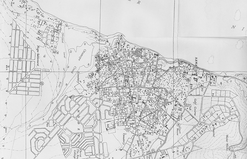
The above view from the distant past shows a map of the very center of Otu-Onicha in 1932: a dense clustering of massive corporate buildings, markteplaces, shops, offices, and residence buildings stretching out from the river’s mostly high banks, into the gradually rising land eastward (down-map here) where new planned developments were being laid out. At the top, directly riverside: the densely packed economic center, with rows of market-stall buildings and larger commercial firms. Toward the far right: the European Reservation, formally plotted from the beginning, with lots of open space (and a golf course!). Toward the far left: new residential “layouts” to accommodate the burgeoning in-migrating (mostly Ndi-Igbo) populations. At very bottom-center: a road intersection, which marks the major boundary: below this, under the arms of the (east-west) Awka Road and the (north/south) Oguta Road, there lies the Inland Town (enu)
Note: On this page we merely outline a sketch of what is meant by the designations “otu” and “Waterside”, aiming to provide the briefest sense of what is meant by this “Heart” of the “two-hearted” city (the oppositioonn to “enu” or “Inland Town”). much-expanded discusions of both sides of the dichotomies appear in Chapter Two, under almost identical headings. Here we merely open some doors to “viewing the city”, so to speak.[Note: Click on any image you may want to enlarge.]
Early 1900s Definitions of Onitsha Spatial Contrasts:
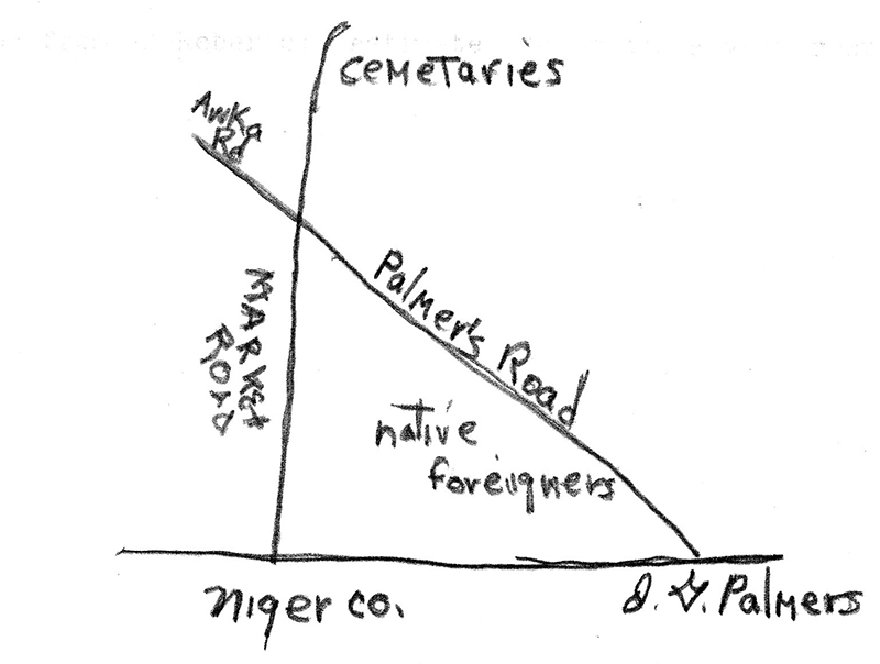
In 1908, the New British Administration raised the question of granting “trading sites” somewhere “above the”Government Beach” to “native foreigners” (e.g., traders from Sierra Leone and other Colonial possessions), in light of the fact that “the Natives of Onitsha are… very anxious that the Native Foreigners should live as far as possible in one Quarter.”…1. The map at left here indicates the location, between what later became Old Market Road (here, latgeled “Market Road”) and New Market Road (“Palmer’s Road”).2 Onitsha people eventually labeled a part of this area “Ogbe-Olinri” (“Olinri Village”), viewing the area from an “Enu” perspective, i.e. naming it after one of their major tradiitional shrines which gave spiritural protection for the original Ndi-Onicha riverside marketplace, called Otu-Nkwo. 3
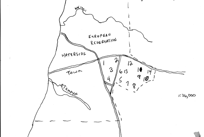
At left, in 1932 a District Officer mapped the situation like this: the “Waterside Town” (Otu) has now spread widely (across both sides of “New Market Road” and well to the north along the river) while the “Inland Town” (enu) is designated simply by numbers referring to the various traditional — descent-group and chief-ruled — villages occupied by Ndi-Onicha. The novel designation, the “European Reservaation”, reflects a massive growth of the European presence by this time.

In the map at left –bear in mind we still loo kbackward here, to 1932 –, at the western bvoundary of “Waterside”, the Bank of British West Africa and the Roman Catholic cluster of properties; eastward, the “Golf Course” and “Club”, Post Office, police barracks, Court House, hospital, numerous residential quarters, various government offices, the C.M.S. (Anglican Church Missionary Society) complex, football field, and “Water Works”. Despite the fact that much of this space lies on higher elevations, from the perspective of Onitsha People (ndi-onicha), this area could be generally described as part of otu (though the entire laid-out zone would more typically be described as “European Reservation”).
The European Reservation, 1960-62
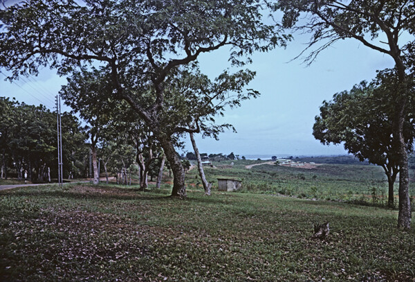
From the far north (the Akpaka Forest reserve), looking south toward the Niger far beyond (and below), the Reservation appears in some places as a vast, open garden.
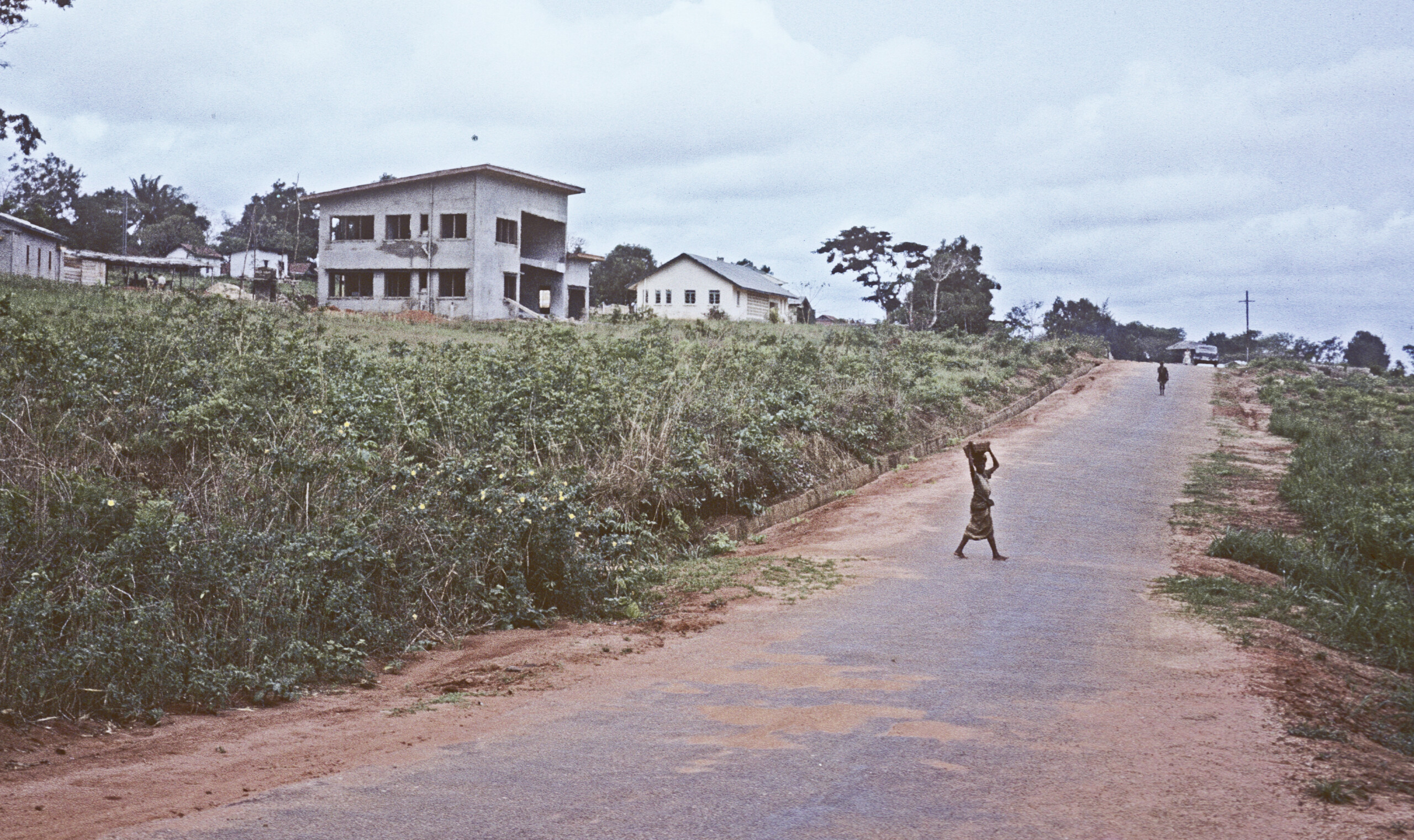
The European Reservation is quite diverse, but it typically has much more open spaces than the rest of the “Waterside”, with grassland spreading widely everywhere. The buildings range from quite old but still operational colonial residence quarters to very modenrn buildings.
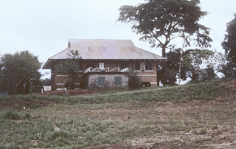
At left, some very old-style residences survive, testimonials to the competence of their early 20th century builders. (See “A Pastward Look” in this Chapter for images from 1911-15).
the “Heart of the Heart”: Businesses around the “Onitsha Main Market”
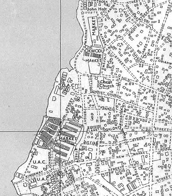
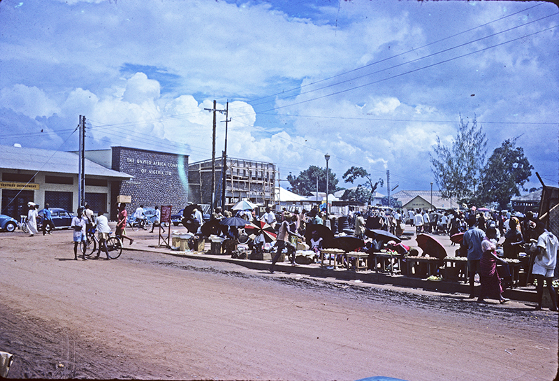
At left, this map shows at the outset the intense density of “marketplaces” along this side of the riverside. At lower left on this map, the dense set of short lines shows the central place of the “Main Markeet” along with its Produce Market, You can see that this complex is flanked on both sides by large structures labeled U.A.C., the grand treading monopoly that controlled business from the early years of this century. Notice then that beyond the northern u.A.C. unit there are two more substantial marketplaces. Onitsha Waterside is a richness in marketplaces. offering very wide varieties of wares.
But let’s begin at ground-level, with the point where the Ndi-Olu traders tie up at the spot closest to it:
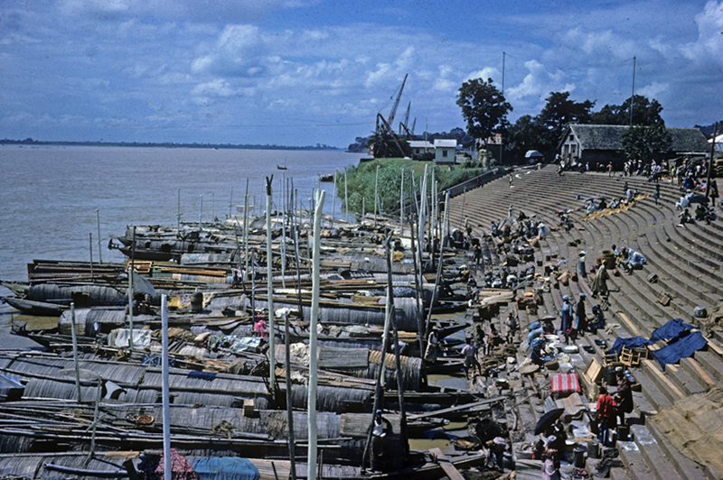
At left, , the prime destination for Ndi-Olu canoe-based traders: the stairways leading from the water to the Onitsha Main Market (wholly reconstructed in the late 1950s.. The span of these concrete stairways (built in the 1950s to replace earthen ramps that tended to become very muddy) was designed to accommodate maximal seasonal flooding of the River (spanning some 35 feet in normal years; here, the river was considerably lower in July of 1962). Note the large cranes at the massive United Africa Company loading docks, prime real estate that the colonial government gave the “ancestors” of this company early in the 30th century, enabling them to control and dominate the economy of the entire area in many waysfrom around 1900 onward.
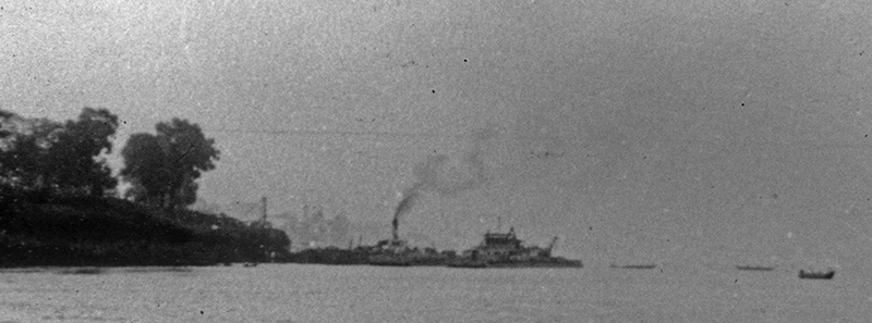
We did not directly observe activities in and around the UAC to any detail, but the UAC dock was the highest point on the River where ships of substaniale draft could navigate year-round, so this dock on-loaded and off-loaded the bulkiest objects being regularly traded on and off the river.
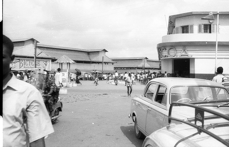
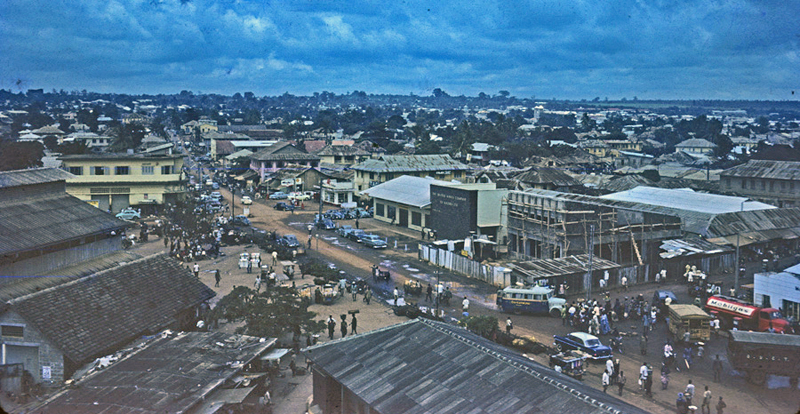
Left, view of the Main Market building from the western end of New Market Road. Note the police kiosk for direceting traffic. At the right side of the image, note the S.C.O.A. Below right, the far end of the complex.
Directly west of the Main Market, the U.A.C. headquarters looms across the sstreet where crods of opportunistic female traders show their petty wares.
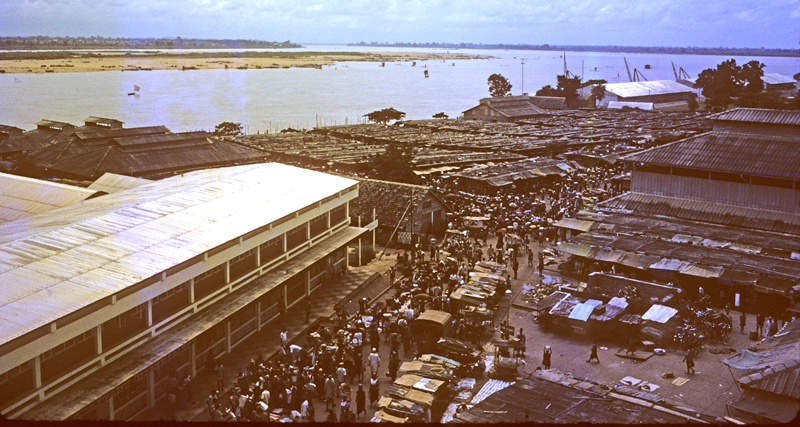
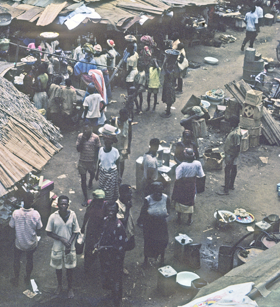
Below, a view from on high of a major portion of the mighty Onitsha Main Market in 1962 (taken from the top of the market’s water-tower) where we see far below a vast and dense expanse of buildings and pathways teeming with traders and their customers, the vast majority of whom in 1962 are Ndi-Igbo. Every space is filled with noises of people pursuing the business of business. Beyond the large Warehouse of G.B. Olivant (lower left), stretches the Produce Market.4
Below, a street-level view of the Produce Market. (In the foreground, women petty traders have laid small patches of grain out on the floor to dry, hoping to sell small quantities that will enable them to trade another day .)
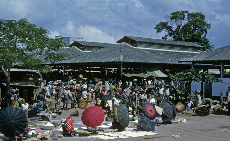
Below, people’s clothing styles in and around the Main Market and other centers of commerce are adapted primarily to work, though even in their everyday apparel women’s wear is often eye-catching.
And note here, particularly in the image at right, the work-oriented dress styles of most participants. Bear this in mind when we engage the “other heart” of the city, in the naext page of this chapter.
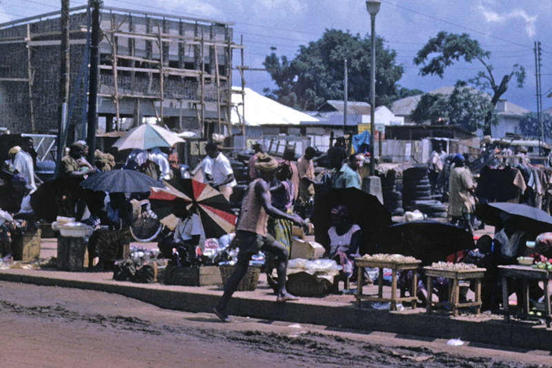
Below, we turn now to look in the opposite direction, where New Market Road, its numerous side-ways extensions of trading establishments, runs out from the Main Market toward the uplands (from lower right to upper left). Nearly all of what you see here is called Otu, “Waterside”, and most of its residents are Ndi-Igbo immigrants. But on the horizon, a green dome with scattered giant trees, rising at image center, marks the second major “heart” of Onitsha Town: Enu-Onicha (“High-Onitsha”), also called the Inland Town, the ancient location of Ndi-Onicha, the self-designated “Onitsha People”, led by their King (Obi) and Chiefs (Ndi-Ichie) and who in precolonial times controlled the entire area where Onitsha Town now lies. They deem themselves as historically renown for their disdain of others5
- No. C 2049/1908 [↩]
- It’s interesting that this road was still named after Mr. Palmer, a Sierra Leonean trader involved in )serious criminal activities around 1877 [↩]
- The Olinri shrine was destroyed by the British at about the time of this Report. [↩]
- Here again, you also see the salient geography of the River beyond: at far upper right, the vast flat stretch of the Anambra Floodplain in a dark hue. At upper left, the Asaba Uplands rises toward the northwest. In the far-middle river, the Ubom stretches down the left-center portion of the Plenitude of Waters. [↩]
- See Azikiwe quotation. [↩]