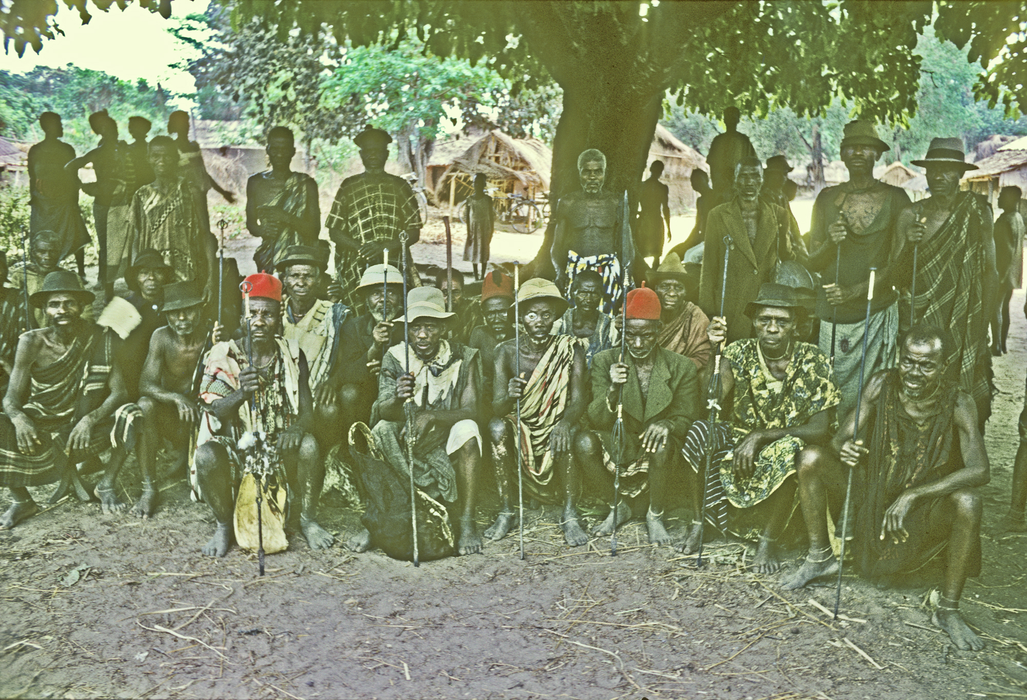
Above, the set of Titled Elders ruling the town
We had been living in Onitsha for well over a year and a half at the time this last “visit abroad” occurred, and were beginning to prepare for our departure. Helen’s personal condition had stabilized; earlier, she had suffered for a considerable time with severe chronic pains behind her left ear, which a trip to doctors in Enugu had not helped, but the condition was eventually solved by some marvelous doctors at the Iyi-enu Hospital in Onitsha who knew how we could easily clear her stubbornly blocked eustachian tube, returning her to her normal cheerful and witty self.
On the other hand, I was –to take a translation from the name “Azikiwe”, that is, “Youth excel in anger” — I was beginning to excel in anger. The Interregnum that had captured my attention for so long was now “on hold”, and I was drifting away from my closest Onitsha contacts, including my fellow members of Isiokwe. I was beginning to act a bit like an angry Onitsha young man — excelling in anger. (I even, in sharp contrast with my previous carefully regulated behavior, spoke harshly to a few respected elders during this time.) Helen’s wit recorded this situation in one of her incomparable cartoons:

Decipher that if you can. “Azikiwe” would indeed have been an accurate label for the person doing the typing here in this cluttered “office”.
At this point I met a young man from Umuelum. He was Simon Odikpo, a teacher at the CMS Central School in Onitsha, who visited me one day and proposed that Helen and I make a visit to his home town. For some reason I leapt at the chance (perhaps feeling a strong need for a “change in venue”), and soon we were on our way in Motu Machis, with Simon Odikpo as our guide.
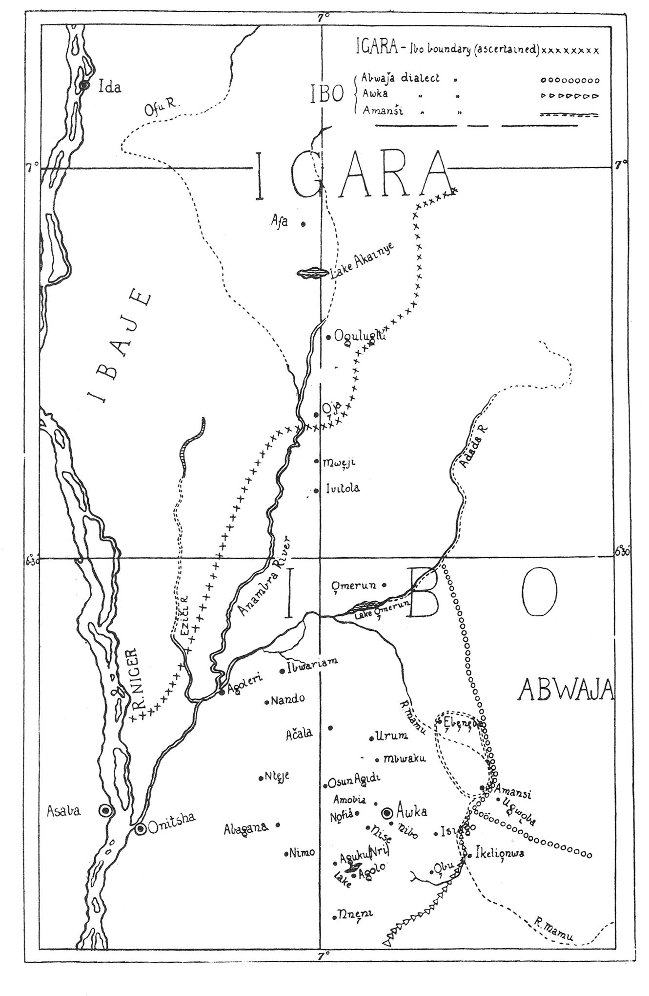
This was the most remote “town” that we visited during our entire stay in Nigeria from 1960-62. By “remote” I mean that, at the time, this seemed to be a place furthest removed from obvious historic British-Colonial influence. In fact, it had quite early received attention from officials concerned with agricultural development, specifically, first of all, production of rubber plants. In my later searches for a suitable map, the first I could find was the one at left, made by the outstanding early ethnographer, Northcote Thomas 1. The town of “Omerun” appears just to the right of the crosscutting central lines in the image and to the south of it appears a lake by the same name. It’s interesting to me that Thomas singled it out, since there are many small settlements in this area, not densely populated because it is part of these lowland “swamps”. This emphasis reflects the fact that the location had some ethnographic importance to him. The spelling of the name, by the way: either Umuerum or Umuelum is standard. (The encompassing “group” — or “family” of villages was labelled “Ayamelumm” by the British D.O. Milne — see further below.)
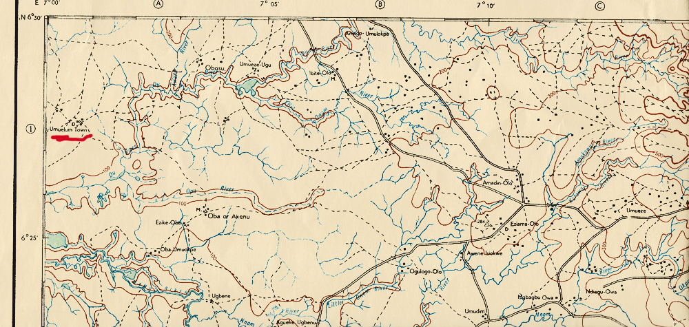
I found a second map, above, showing the location, here in the northwest corner of a 1959 map of what was then “Udi Division” of Eastern Nigeria. Here the correctly spelled “Umuelum” appears in the northwest corner of the map with its “lake” unnamed but evident nearby to the southeast. Here you can see how limited the village populations are in the immediate vicinity of Umuelum compared to the lands further east and southeast (and located beyond the lowland swamps).
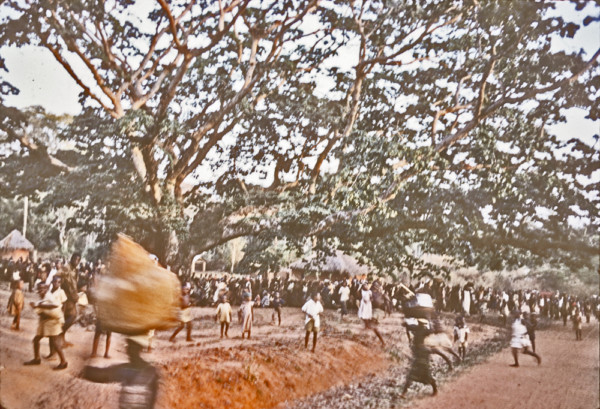
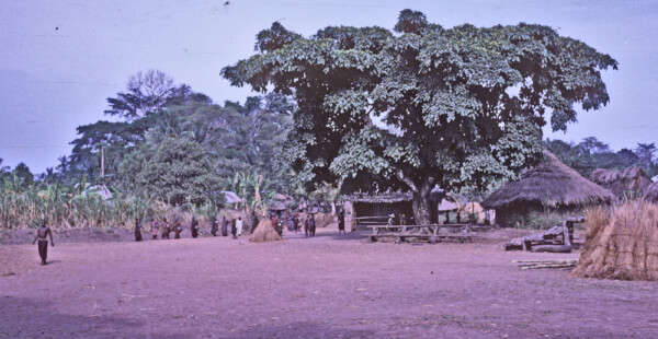
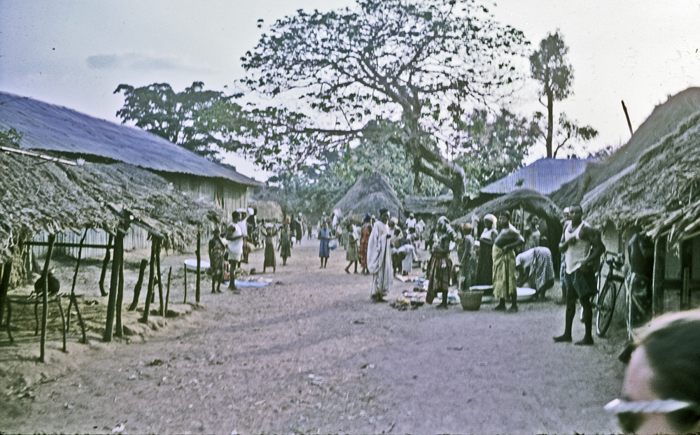
Our first real view of the town was this concerting image below, a blur since I was driving at the time. What was remarkable was the image of this huge, vastly wide-branched tree, with a large, bustling crowd dispersed around and beneath it. In the foreground, what appear to be school-uniformed youths, apparently engaged in some kind of formal activity.
Below, we arrive at the location of our hosts. You can see in the distant background the swamp lands where rice is being grown. The sign on the tin-sheet building says “Ghana Rice Industry Depot”.
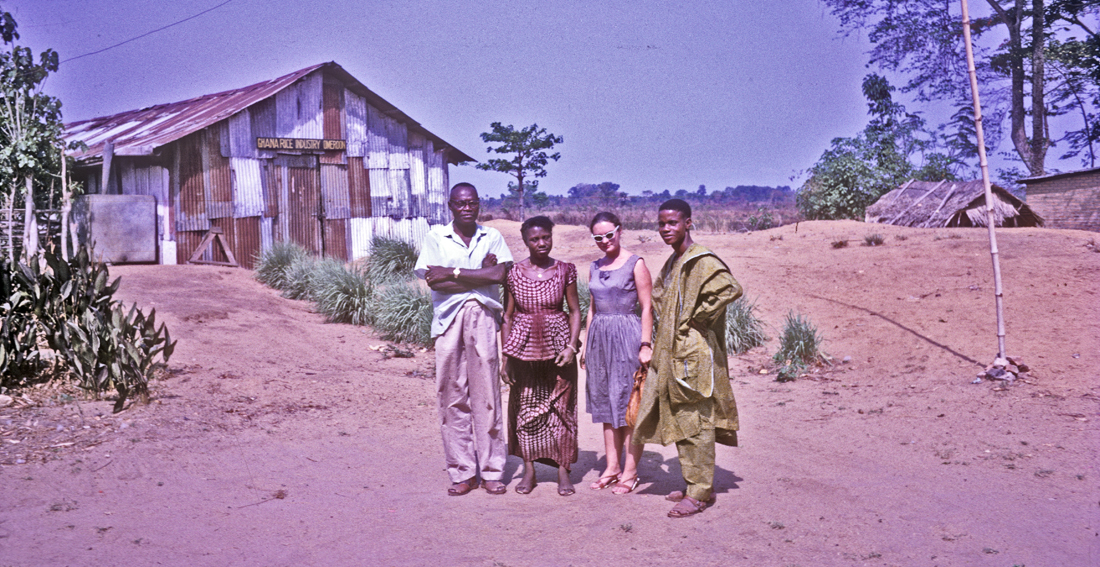
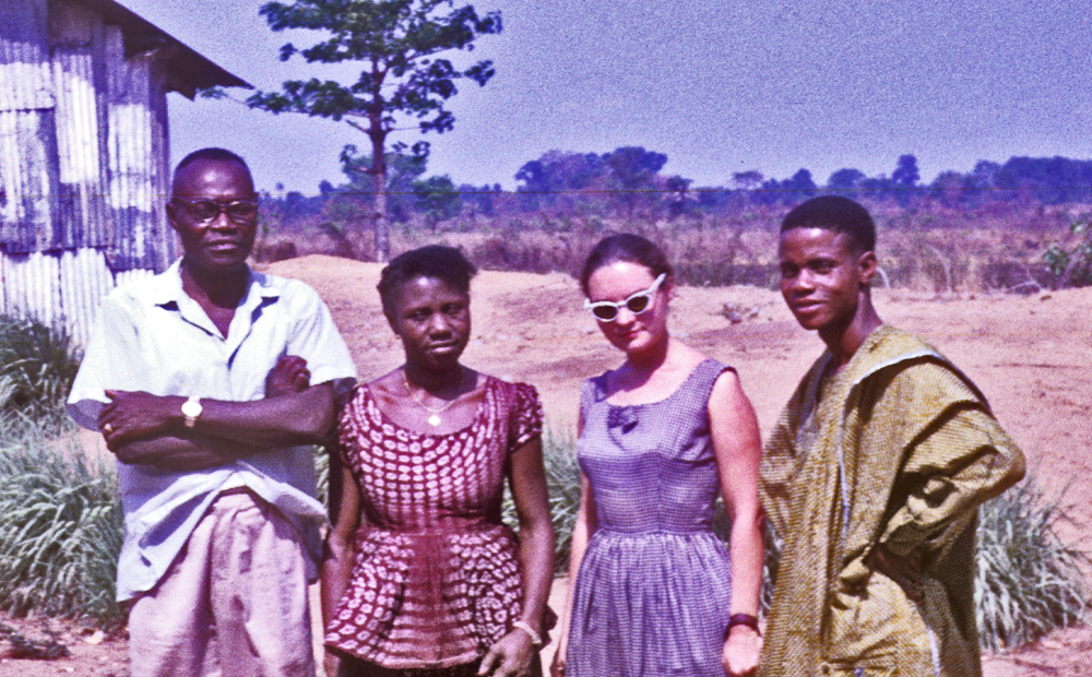
At left, Helen stands with Mr. Odikpo and our hosts, a man of middle age, whom I believe was named Mr. Haffner, and his wife, running this station. You can see how this location is situated well above the swampland in the far distance.
We did not explore the situation of the station, nor even talk at length with our very generous hosts, who provided us with housing and fed us delicious food during our brief stay. We did know that they were members of the CMS (Church Missionary Society), in this location where the RCM stood in sharp opposition. We quickly discovered there was tension in the town regarding our presence, since obviously we must be members of the CMS. Devotees of the RCM no doubt held some suspicions regarding what intentions our sudden presence might forebode.
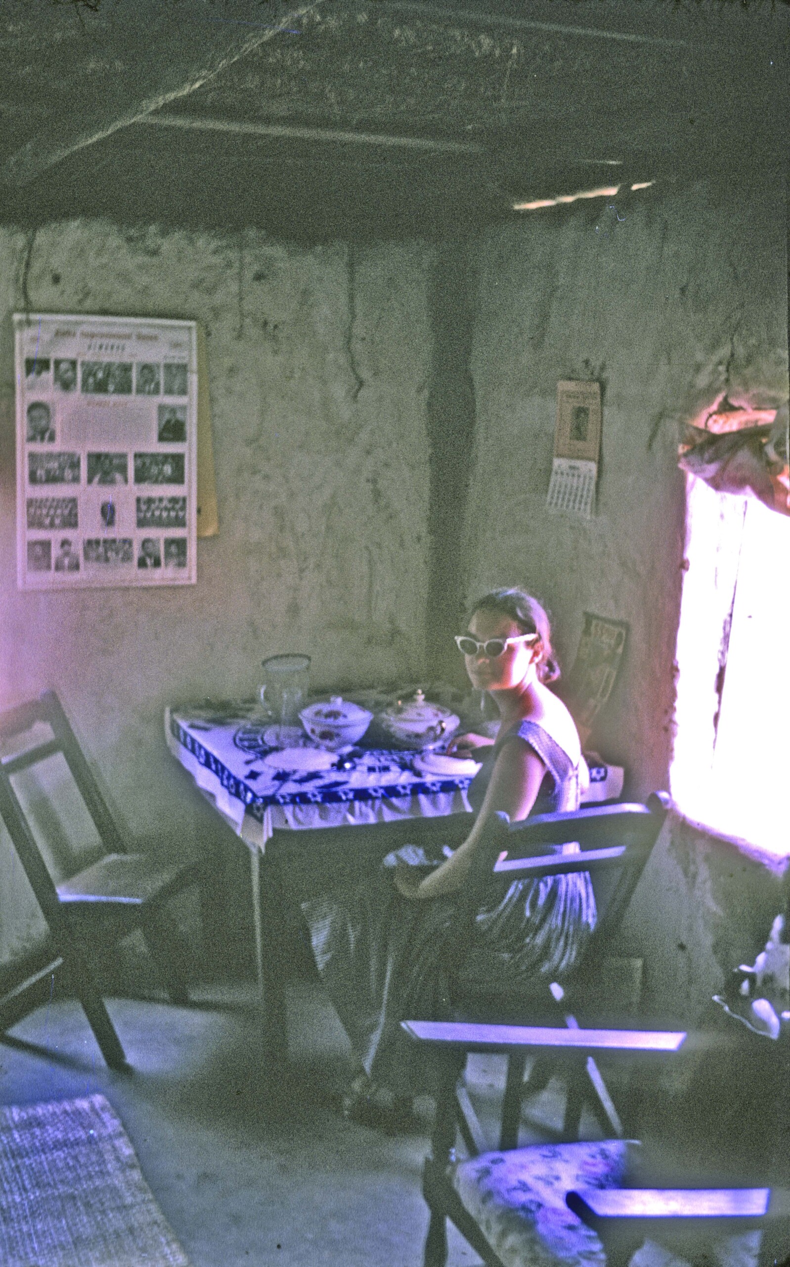
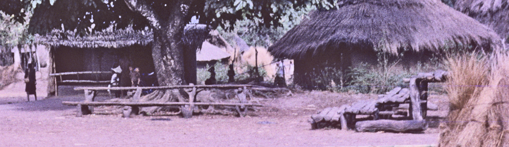
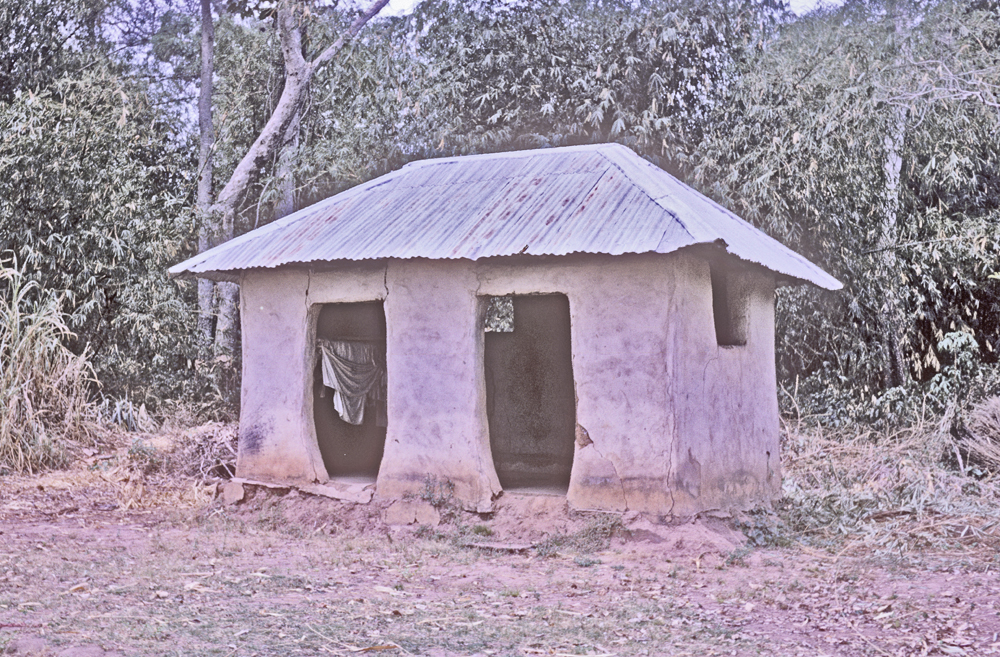
Our hosts provided us with a small, lovely thatched-roof cottage to stay in. I took this photo of Helen sitting at the table. It was May, and hence before the rainy season, but one night the wind blew gustily and a few drops of rain fell on the roof. It was a very pleasant experience to stay in a thatch-roofed house, and I became a fan of this kind of roofing. (We later had more experience of these in Burkina Faso, when occasionally small birds would flit through the roofing sticks and charm us with their beauty.)
Apparently the vicinities near Umuerum were an early center of trade connecting Igbo-speakers with communities located further north, involving people sometimes labeled “Hausas”. Early Igbo-speaking people involved included blacksmiths from Awka and traders labeled as “Ogbaru”. Onitsha people came later with early European authorities.
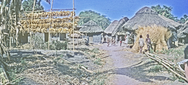
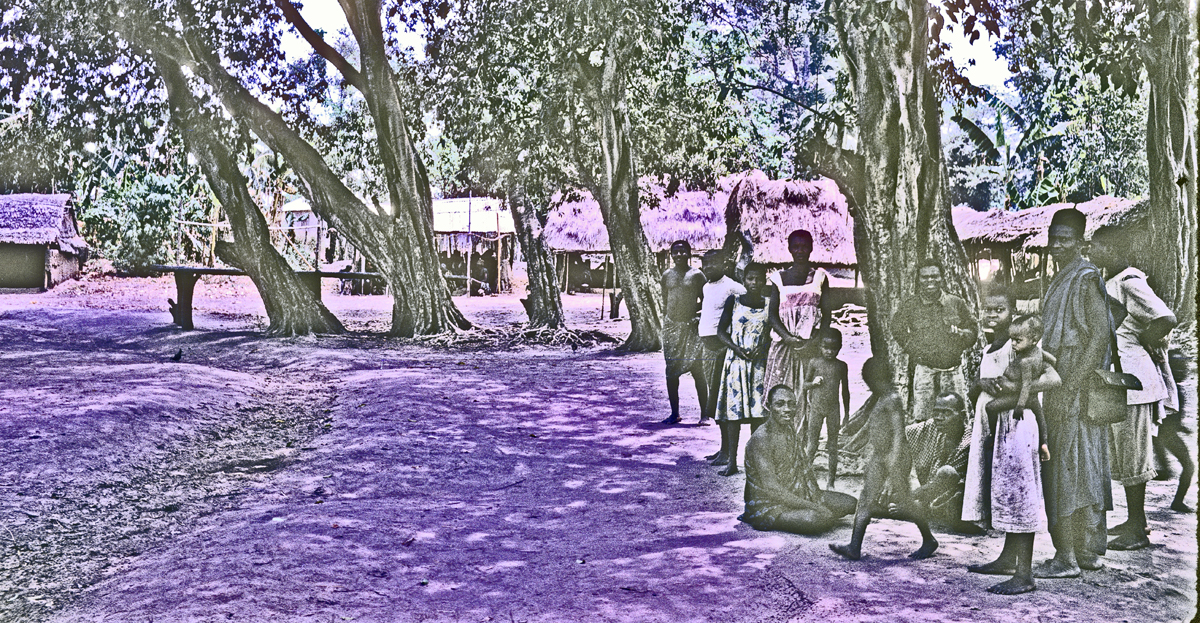
Below, the main “Village Square” (ilo) of Umuelum. This was a very fine open one, and (like all Village Squares), this one had a tree, but a tree of startling magnificence. The central activities of the people operate, so to speak, under the moral aegis of this great tree.
Beneath it, there are some activities going on.
Below, you can see a group of women heading off in procession toward somewhere else. Most of them are carrying a similar circular-appearing object, perhaps a seat for making oneself comfortable at the marketplace.
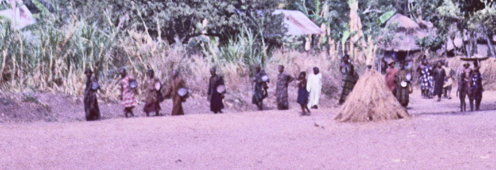
Below (from the same primary image above), you can see that beneath the arms of the giant tree, a row of seats has been placed so that its occupants can confront an audience facing them from the larger square. This arrangement places authority figures along a single line. Off to the right (to the left of the authority seats), it appears that a secondary array of seats — perhaps designated for lesser authorities — is placed to face toward the central occupants.
These are very typical patterns among Ndi-igbo, making us feel “at home”, though the visual qualities of this location are very distinct.
…………………………………………………
Below, a boundary which I’m guessing marks a distinctive sub-village behind it. The mud structure might also control runoff.

Closeup of the image above indicates what looks like an Oda medicine pole, notifying potential visitors that the premises are protected from strangers who may enter while bearing ill will.
Below, what appears to be another village boundary marker. At left , a substantial “barn” storing shocks of corn, at right, recently cut roof-thatching material.
Below, a local marketplace. Some figures at middle distance appear to wear Muslim garb. 2
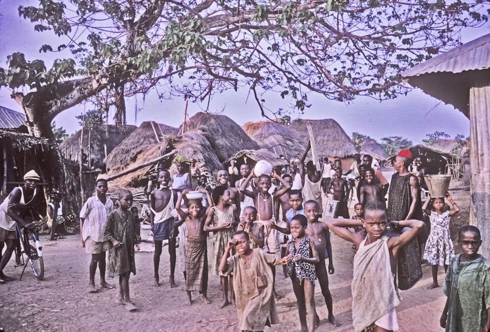
Below, a closer view of the villagers here. Most villagers appeared friendly, though (as I said earlier) some sharp division was present along Catholic/Protestant lines. (Note the figure at right wearing a red cap. Historically, “red cap chiefs” were very important in Igboland, and while this figure displayed no obvious distinction, the cap likely signaled some significant role.)
Several marketplaces were operating in the village group. Here below is another one, probably associated with another village in the “Village-group”. Behind the trees one can discern villagers gathered under the tin roofs.
Left of the previous image, we see another roofed enclosure occupied by a substantial group of people meeting for some social purpose.

1933 British Official Milne’s Diagram of Umuelum Village Structure
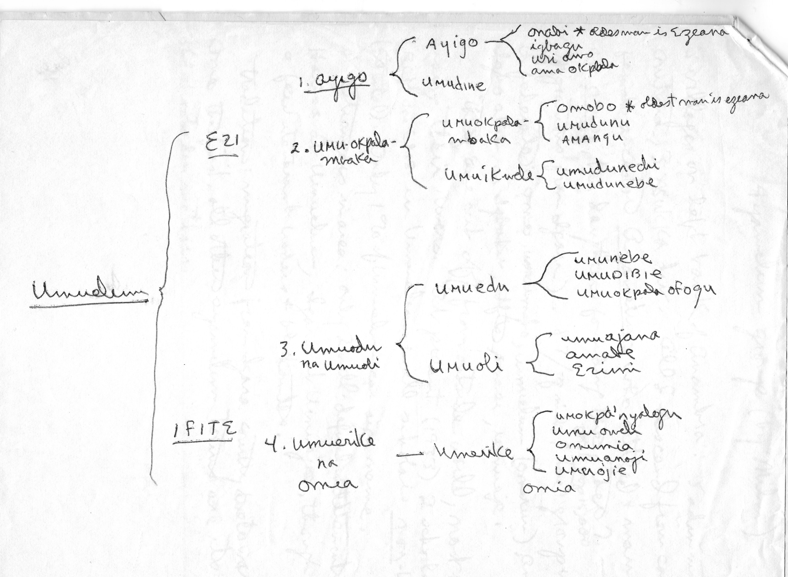
Some time after our research in Africa, I found this British officer’s report in the International African Institute Archives. Mr. Milne was active in the Province in the 1930s, when he compiled this overview diagram of the social structure of Umuelum, which I have copied for presentation here.3 This diagram shows us a frequent form of Ndi-Igbo Village- Group for this region, with a dual division at the maximal level between an Ezi (“senior”) half and an Efitite (“junior”) half, each of these subdivided in two halves, making a total of four sub-villages, each with its own marketplace (operating one day of each four-day Igbo week). We presumably saw two of these marketplaces, one of which was active on the day we visited.
Interestingly, Milne’s report also tells us that the town of Umu-elum is part of a larger descent-linked community called Ayamelum, comprising “eight villages on the left bank of the Anambra [River], all descended from a female ancestor by that name who (after leaving Igala country) settled at a place by that name and had seven daughters” (who formed the other villages of the group). In 1933, the eight villages were hoping to form a “confederation.”
……………………………
A glimpse into Mr. Odikpo’s descent group
We went to see our young man’s major patrilineage priest, and passed outside one of the patrilineage’s shrine houses, below:
Visible inside is a cloth that the shrine has “worn”, indicating the fact of sacrificial offerings having been made to it (something of a symbol of its power).
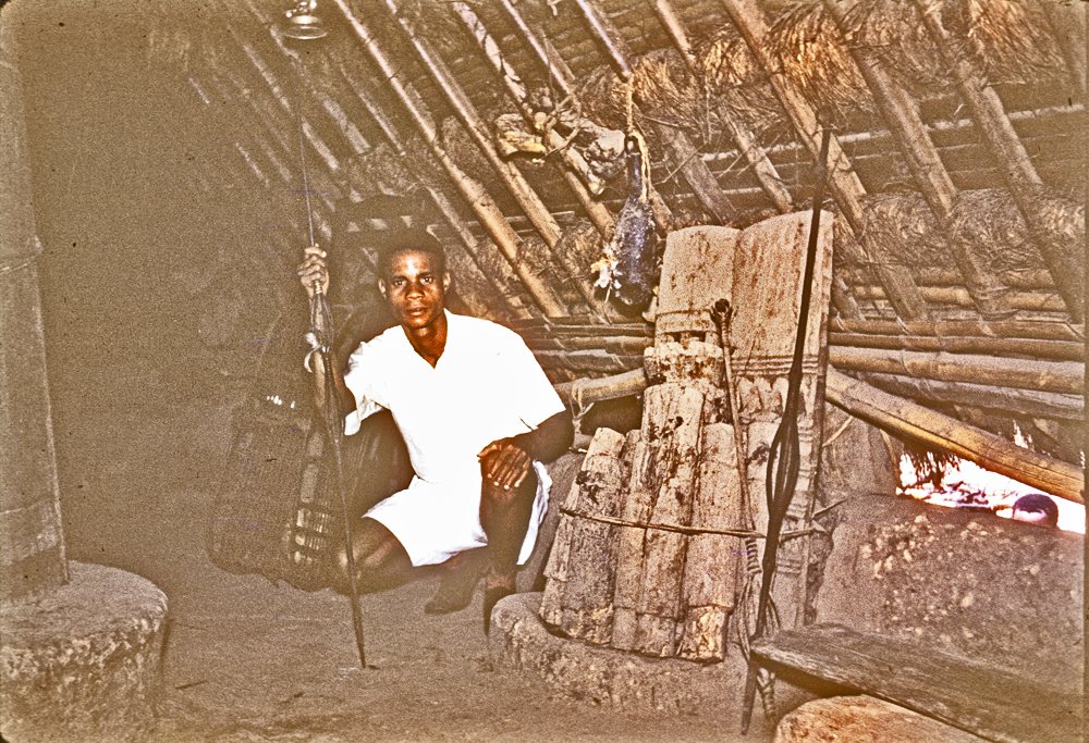
First we went inside his own personal house, where he showed me the altar, presumably of his own close lineage. I infer this as this is the only occasion where he personally holds the iron staff of authority — to indicate that he is in the line of succession here. I presume the altar beside him represents an array of ancestors. Note here how the rafters above show the signs of numerous prior sacrificial rituals, an impressive suggestion (to me) of the community’s ongoing sense of responsibility to its people.
Below, the patrilineage altar of our young man’s wider descent group.

This is the first time I have seen an altar in the shape of a mound with a hollowed-out center containing the “Ghosts” (ndi-mmuo) of the descent group. These are wrapped as a bundle, and include iron spears and staffs, and wood staves, the latter presumably dedicated to untitled ancestors. A very large, skin-wrapped ofo stick denoting the ancestral righteous power of the priest lies there beside them, gleaming from past blood sacrifice.
Below, the presiding lineage priest sits besides the ofo of his descent group, holding a large “doll-sized” figure designed to embody considerable power:
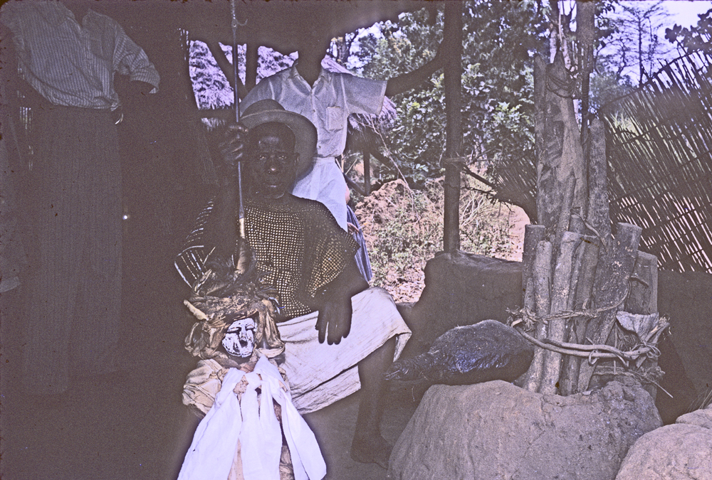

I am entirely unsure of what to call this figure, but it is clearly an icon of some importance. It wears a white feather indicating Ozo title; it is draped with an array of white cloths (indicating that this is its expected/required ritual dress-offering); and it sits upon an Ozo title stool. All of these iconic features proclaim it as a figure of spiritual power. The priest of this complex is clearly a powerful person also. I would speculate that this complex figure may well be referred to as an Alusi (Spirit Power).
………………………………………………………………
We proceeded to a meeting place where a much larger group of titled men had just completed a series of offerings. I call them “assembled clan elders.”
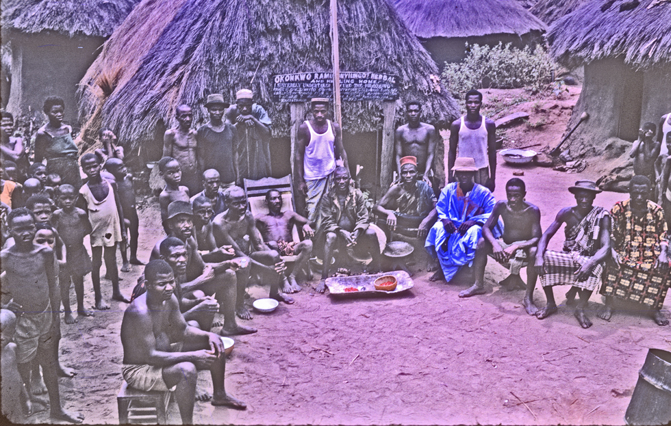
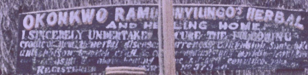
The titled men are seated at center, boys and youths at far left. They were in the act of concluding a set of ritual offerings to sacred objects to be shown below. The location was in front of a hut emblazoned with the label “Okonkwo …… Herbal and Healing Home”, suggesting that a leading elder of the group, who is sponsoring the event, is a native doctor (dibia).
I cannot decipher the full text of the message, but probably the words below “Healing Home” indicate some of the ailments dealt with at this location.
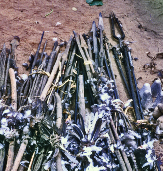
Below, an array of iron spears and staffs, and wooden staves, lay on the ground having been given substantial sacrifice on this occasion (as indicated by the large number of chicken feathers strewn about).
……………………………………………….
Below, the titled elders (and others working to organize the group photograph of the elders) meet to discuss the process.

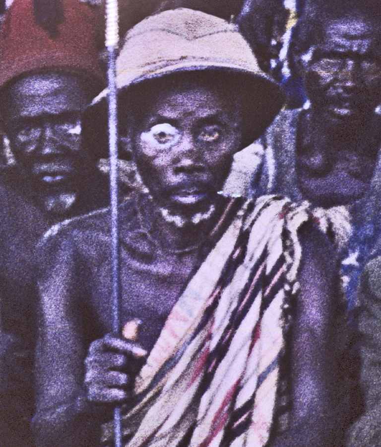
Note the elder with the “spirit eye”, cropped from the image above. These figures always caught my attention wherever I saw them in Igboland. This indicates a person in a special spiritual condition, but I failed to inquire more closely into the meaning of this facial icon.
Note that this elder holds an iron spear as his staff of office. Here at Umuerum was the one place where I saw these ritual spears in action. In his study of Nri, M.O. Onwuejeogwu 4 repeatedly mentions the importance of the “spear of peace” (otonsi), which Nri Ozo men carry as signs of their interactive authority. I had no opportunity to discuss these matters with the men of Umuelum, but I was repeatedly struck by the sight, during official meetings where men holding such iron spears spoke. They would preface their speech by raising, then thrusting their spear-points into the ground. There were varieties of iron spears visible in Umuelum, which must have had considerable symbolic importance.
All of this ritual activity suggested to me a thriving sociopolitical system in which titled descent group elders held strong and effective control, which was what in fact my young guide was telling me.
Mr. Odikpo said that while younger members of the society were trying to gain some control over Umuelum farm lands so they could begin investing in the rice fields that were producing great riches there, the elders were refusing to allow this, claiming that their various oracles were directing them to hold the younger men back, and to continue their policy of accepting regular payments being given to the local elders by businessmen outsiders — who now were busy building and enlarging their very successful swampland rice projects, making great profits there.
Milne’s 1933 account repeatedly emphasized the very strong emphasis placed on age seniority in this system. There is a title-obtaining system in operation — through which younger persons can “buy age” — but overall, and in many and various contexts — age seniority defines this authority system. In this context, very old — and little educated — leaders profit greatly, but the outside entrepreneurs — what 1950s colonial officers called “Big Businessmen from Onitsha” — dole out very small change to them while reaping enormous profits.
………………………………………….
In the 1960s, I never learned more about Umuelum. Mr. Odikpo tried to reach me in Onitsha as we prepared to depart, but — my then-chronic anger at my current life-situation had grown back to full strength, and I gave him short shrift. (It hurts to write this last phrase, but that is the fact. )
Today, below, a satellite view of Umuerum and its adjacent rice fields, now grown to vast spreads of close-planted terrain. It makes me wonder if the people of Umuelum are getting anything approximating a fair share of the profits arising out of this complex.
